- Richard Ferdig
- http://www.ferdig.com
- Summit Professor of Learning Technologies
- The Use of Mobile Applications for Informal Learning in Parks
- http://parkapps.kent.edu
- Kent State University
- Kristine E. Pytash
- Associate Professor
- The Use of Mobile Applications for Informal Learning in Parks
- http://parkapps.kent.edu
- Kent State University
- Karl Kosko
- Assistant Professor
- The Use of Mobile Applications for Informal Learning in Parks
- http://parkapps.kent.edu
- Kent State University
- Patrick Lorch
- Manager of Field Research
- The Use of Mobile Applications for Informal Learning in Parks
- http://parkapps.kent.edu
- Cleveland MetroParks
- Cheng-Chang Lu
- Professor
- The Use of Mobile Applications for Informal Learning in Parks
- http://parkapps.kent.edu
- Kent State University
- Bridget Mulvey
- Assistant Professor
- The Use of Mobile Applications for Informal Learning in Parks
- http://parkapps.kent.edu
- Kent State University
Public Discussion
Continue the discussion of this presentation on the Multiplex. Go to Multiplex


Richard Ferdig
Summit Professor of Learning Technologies
Thank you for visiting and learning more about our NSF-funded project called ParkApps (NSF AISL #1422764). We have completed our build and are in the process of collecting data. If you haven't had a chance to download the app, it is free and available for both iOS and Android at: http://parkapps.kent.edu. We welcome all viewer comments and questions! We encourage viewers to help us think through important topics including but not limited to: a) broadening participation; b) disseminating and engaging with others during and after our grant cycle; and c) the challenges and best practices of collecting data in informal learning environments.
Heidi Carlone
Patrick Lorch
Claire Quimby
Research Associate
Hi Richard! This app looks really well-designed with lots of different opportunities for engagement. I'm curious how your team has gotten word out about the app to encourage people to use it.
Richard Ferdig
Summit Professor of Learning Technologies
Hi Claire: Thank you for your kind words! This partnership is a real team effort with collaboration from computer science, science, education, communication, instructional technology, literacy, math, and obviously our parks! That helped create a well-designed app with lots of fun and engaging opportunities. Our team has spread word through lots of different channels.
1. Social media. Social media has been our friend! We have used Twitter and Facebook to help spread word.
2. Parks. We have done a number of different things through the parks. For instance, we visited Harper's Ferry (the mobile development center) to share our work. We have also engaged scientists and rangers in both parks (it obviously helps having staff from both parks on our grants). Finally, we have utilized the internal volunteer networks at the parks (both have large volunteer groups).
3. Schools. This is a grant aimed at informal learning. But, spring and summer have brought parent groups as well as schools and camps doing field trips. Although both parks have exceptional educational programs, our app can supplement such activities--particularly when rangers aren't available or during last-minute adventures.
4. Scouts. Our community is historically very supportive of Boy Scouts, Girls Scouts, Trail Life USA, etc. (There is even a camp within the park boundaries.) We have worked with leaders in these programs; we have even had an intern work with us who was an Eagle Scout!
Probably one of the coolest things that happened actually took place last summer with "Cicada Mania." We originally "locked" the adventure tracks, making sure the person had to be in the parks to get access to the content (hoping to force park visits). We quickly realized there were users who may not be able to do certain tracks because of accessibility issues. Opening up the tracks for virtual participation meant that anyone, anywhere, could see our content. Fast forward to Summer, 2016 and the the billions of cicadas taking over our area. There were lots of people around the US who weren't experiencing this, but they could still use our adventure track to "virtually explore" and learn from their location. Who would have thought an insect could help spread the word?
One of the best features of our app is that arguably anyone could quickly adapt our app to their part of the world (users can already create their own in the My ParkApps feature). We're now exploring how to get word out so that others can share from our experiences and our builds.
Best, Rick
Sarah Garlick
Joni Falk
Claire Quimby
Research Associate
Thank you Rick! This is very helpful and gives me lots of ideas to discuss with colleagues who are considering similar projects.
Richard Ferdig
Carol Boston
Lots of features on this app! The pop-up question feature seemed especially engaging for hikers. As I watched, I wondered if the questions are geared for a particular reading level--say high schoolers or adults? Do you have any data about how families are using the app yet?
Sarah Garlick
Richard Ferdig
Summit Professor of Learning Technologies
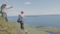
Thanks for your comment, Carol! One of our first adventure tracks was near ledges. We quickly realized the value of "pop-up" questions. We didn't want people staring at their phone and walking off cliffs! So, the pop-up feature lets people put their phones away and only pull them out near an area of interest---either an area we have designated OR an area they mark.
Your question about readability is key. Most of our content is aimed at a 4th-5th grade reading level. However, we also know the need to reach younger audiences through content in addition to reading level. As such, we created some adventure tracks specifically aimed at parents/families taking kids on hikes (e.g. Youth Fall Colors). It helps that many of our project members are parents of young children!
In that same token, we wanted to reach advanced users, too. Some of our citizen science projects actually require advanced training by users. The app lets advanced users take training; once they get a badge, a data collection project opens up. We're never going to be able to reach all audiences perfectly, but we're doing our best to provide as many tools and opportunities as possible (e.g. a journal for both beginner and advanced users, a map creation tool, citizen science projects, etc.).
Your last question about data is our toughest challenge. In addition to having different visitors every day, we also have strict limitations (from the parks or from our own internal research bureau) about what data we can and cannot collect. We are collecting and analyzing lots of data now but we look forward to input from others on their best practices in collecting data in such environments. Thanks! Rick
Claire Quimby
Sarah Garlick
Joni Falk
Really enjoyed this presentation. Hope you connect with Martha Merson (see http://stemforall2017.videohall.com/presentatio...) who is also working on educating visitors to the National Parks. I like that the app both gives information and has parts that encourages exploration, which of course is essential in the National Park. But having something to look for... must really help. How do visitors get encouraged to use the app? Is the app park specific? How many parks are included? Did you work with park rangers in the development of the app? Great work. Thanks for this video!!
Richard Ferdig
Richard Ferdig
Summit Professor of Learning Technologies
Hi Joni: Thanks so much for your note. Interestingly, Martha and I met at a 2016 AISL conference. She was great in helping me think through some of the difficult IRB issues at National Parks. But, thanks for reconnecting us--I viewed and commented on her video; I look forward to seeing if our projects can mutually support each other.
I'll try to give short answers to your questions, but a little history may help! We submitted the NSF proposal with Cuyahoga Valley National Park (CNVP). By the time we were funded, one of our PIs (Dr. Pat Lorch) left Kent State and began working at Cleveland MetroParks (CMP). We received CVNP and NSF's permission and added CMP as one of our parks. It was really a blessing on multiple accounts. First, because CMP and CVNP overlap, CMP was able to support us with maps and insight into geofencing. Second, one of our grant reviewers wondered about the feasibility of having this be implemented at more than one park. Having two parks on board let us test this question right away!
With that history, the app is both park specific and park neutral. It's specific in that it addresses content and contexts that are located at either CVNP or CMP. However, it is neutral in the sense that anyone anywhere could easily adapt it and create content for their location. They could do this on their own in the "My ParkApps" feature; or they could work with our system to easily create a ParkApps (pick your location) instead of a ParkApps NE Ohio. I've been encouraging this from day one; it's not because we don't enjoy our relationship with our two parks--we love them! But, we've built this great tool to encourage informal science learning and I'd love to see people use it around the world.
Both parks have worked with us on development. Not only have they provided interns and 'seasonals' to work with us, but they have provided scientists to help us think through some of the citizen science projects. We wouldn't have had a project with their support in development.
Thanks again for your questions and the connection! Best, Rick
Claire Quimby
Rob Wieman
As a Delaware resident, I was especially gratified by the inclusion of Blue Hen Falls in the video. Great work!
Richard Ferdig
Richard Ferdig
Summit Professor of Learning Technologies
Hi Rob: Thanks for your comment! I'm not sure if you ever make it out to Northeast Ohio, but if you do, let me know and our team will take you out to visit the falls. :) Best, Rick
Heidi Carlone
Professor
This is great work, team! I can absolutely envision using this app with teachers, pre-service teachers, youth, and my own family. I was especially intrigued by all the different features of the app. My favorite aspect of the app may be the emphasis on history of place, which is incredibly important and so often overlooked. Which features of the app do you think function best? If you could make one (or more) tweaks, what might they be?
Claire Quimby
Richard Ferdig
Summit Professor of Learning Technologies
Great questions, Heidi! Our app was funded to promote informal science learning; we've enjoyed having parents and families (particularly of young children) use and learn from and with this app. Having said that, teachers have been some of our biggest advocates (three of our grant project members are teacher educators). We find that teachers want to take their students outside to promote out-of-class learning and even to encourage a love of nature. However, they may not know how and we believe this provides a great educational scaffold for teachers and learners.
There are six features. I know it's not fair to say that I'm excited about all of them! Let me, therefore, say that I really love four of them. :) The adventure tracks provide a guided educational experience that is missing for park visitors who don't have the chance to spend time with a ranger or interpreter. The citizen science projects provide a way for scientists to learn from visitors instead of just disseminating information to them. The identify feature links to iNaturalist so that park visitors can get help identifying things--potentially increasing their interest in learning more about science. Finally, MyParkApps lets users create their own experience by building a map of favorite places (a tool they could use around the world) and a notebook of their experiences (mimicking what a scientist would do). I think these four work together to create an innovative experience in our parks.
It doesn't mean I don't like our other two features. :) However, the map feature is pretty typical of what you would expect to see in other apps for parks. I feel like the team did a great job in supplementing this map with cultural, historical, and scientific information. Sometimes it's just hard to tell a comprehensive story by only looking at one point. Said differently, the map feature works and works well and is arguably necessary for navigational purposes. The challenge is to put enough teasers in the map points to get visitors to try out an adventure track or citizen science project.
The other feature that really needs tweaking is the "Learn As You Go." The idea here was to create mini-adventure tracks that were like Easter Eggs (hidden things) in the parks. They would "pop-up" when you walked and we hoped people would use this as a way to continually learn. People who couldn't find the hidden objects could use our social media posts (or others) as ways to find them. The feature technologically works, but most of our energy has been put into cultivating the scientific explorations of adventure tracks and citizen science projects. The feature needs some rethinking to make it work properly.
Thanks again for your questions! Best, Rick
Heidi Carlone
Martha Merson
I wonder if the Learn as you go feature is similar enough to geo-caching that you could benefit from talking with a geocaching expert? I met Jenn Seva at a conference in 2016. She's interested in parks jenn@geocaching.com.
Patrick Lorch
Patrick Lorch
Hello Martha. I am the partner at one of the parks involved in the development of this app.
You are right about there being similarities between geocaching and aspects of our app. National parks do not generally allow geocaching. We do allow it in a limited way in our parks. Your suggestion makes me think of a new way we could use our app. It could be used to set out virtual geocaches for special events. These would pop up if you had the app on and followed some clues, then the Learn as you go point could send you off in search of the next clue. You could get a badge at the end for completing the hunt.
Richard Ferdig
Sarah Garlick
Director of Science Policy and Outreach
Great presentation! I'd love to have an app like this for virtual tours at our field station. I was wondering if there is a built-in mechanism for gathering user feedback and if so, what sorts of things you've been learning from users. Thank you for sharing!
Richard Ferdig
Richard Ferdig
Summit Professor of Learning Technologies
Thanks, Sarah! Happy to chat more with you about how our app could be adapted to fit your field station. As I shared in my response to Joni, we've built it in such a way that it is essentially web-driven to update app content. We did that for purpose of easy dissemination and updating long after the grant is over.
To answer your question, there are multiple mechanisms for gathering user feedback. If feedback is "data", users input answers based on adventure tracks, citizen science projects, and even identification. That information is helping us analyze what they're thinking about, what they're learning, and what they find interesting. Data also consists of app-based information that can help us analyze what locations and what app features are popular. Data is still being collected and we hope to have some research-based answers and practical implications this summer.
Feedback could also simply mean user feedback about the app (e.g. do they like our app, find it interesting, etc.). We do have that ability through our app (again, data analyses forthcoming). However, we also added a feature to our app and to our website for people to provide feedback, suggestions, recommendations, etc.
I'd love to be writing to share 10,000 pages of what we've learned. We have a lot of anecdotal evidence on it's positive implementation, but we're not quite ready to share what we've learned without some more data this summer. How's that for piquing interest? :) Thanks for the question. Best, Rick
Sarah Garlick
Martha Merson
Well done! I didn't realize you were designing in a way that could be easily adapted to other parks. The park system has such diverse landscapes, cultural and natural resources, that figuring out ways to be relevant to all park units is a real challenge. What would you say the investment is for a new park to customize for their site -- I mean in terms of staff time for content, expertise, design, etc.
Heidi Carlone
Patrick Lorch
Richard Ferdig
Summit Professor of Learning Technologies
Hi Martha: That's an excellent question and one I would definitely answer differently today than I would have a few years ago. I'm unfortunately going to have to give you a vague answer. A lot of our development with the park included testing and re-testing features. As such, we don't have an example of working with a new park now that the app is live and functional.
Theoretically, if a park has educational content, the 'only' investment (yes, please notice the quotes!) would be the time it takes to learn the web-system for adding content. I don't think they would have to spend a ton of time on design of the app; it would be more of an 'a la carte' of what existing features they wanted to add.
Having said that, realistically, as you know well, content developed for interpreters, for handouts, and even for other media don't necessarily easily or automatically fit into the bite-sized chunks of content that are presented through mobile devices. I would also add based on our experience that a new park would probably end up evaluating their existing content even if they think they're content is good to go at the start.
That's an incredibly long way of saying we're excited to try as we feel like the back end is at least set-up so that a park could immediately begin to examine their content (an unintended but positive consequence of this grant).
Best, Rick
Sarah Garlick
Elizabeth Warrick
Great app! Richard, I found your comment that social media has been a good friend very interesting. Have you found that users want to engage with you in many different ways, or have you mostly used Facebook and Twitter to spread word about the app?
Richard Ferdig
Summit Professor of Learning Technologies
Thanks, Elizabeth! There are a variety of users who might be interested in using our app. Some of them who may not already be connected to the parks may find us through social media or may use social media to connect and engage. However, there are already longstanding groups (e.g. volunteer, community partners, etc.) associated with both parks. Said differently, some may engage directly through us while others engage through our collaborators. Finally, because our app features, we also see traffic and engagement through our citizen science projects and communities like iNaturalist. That's a really long way of saying there are lots of inroads to try to engage visitors! Best, Rick
Further posting is closed as the showcase has ended.