- Emily Peterson
- Post-Doctoral Scientist
- Cognitive and Neural Correlates of School-Based Improvements in Spatial Thinking
- James Madison University, Georgetown University, Northwestern University
- Nhi Dinh
- http://nhidinh.net
- Lab Manager
- Cognitive and Neural Correlates of School-Based Improvements in Spatial Thinking
- Georgetown University
- Adam Green
- http://cng.georgetown.edu/
- Assistant Professor
- Cognitive and Neural Correlates of School-Based Improvements in Spatial Thinking
- Georgetown University
- Emily Hollenbeck
- PhD student
- Cognitive and Neural Correlates of School-Based Improvements in Spatial Thinking
- Northwestern University
- Bob Kolvoord
- https://www.jmu.edu/isat/people/faculty/kolvoord-bob.shtml
- Dean
- Cognitive and Neural Correlates of School-Based Improvements in Spatial Thinking
- James Madison University
- David Kraemer
- http://sites.dartmouth.edu/kraemerlab
- Assistant Professor
- Cognitive and Neural Correlates of School-Based Improvements in Spatial Thinking
- Dartmouth College
Facilitators’
Choice
Choice
Public Discussion
Continue the discussion of this presentation on the Multiplex. Go to Multiplex



Emily Grossnickle Peterson
Post-Doctoral Scientist
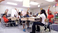
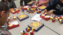
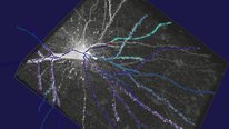
Welcome to our video! This summer, we are completing data collection on this longitudinal project examining cognitive and brain-based changes in high school students taking a course using GIS (Geographic Information Systems). We're excited to share information about the GIS course, the Geospatial Semester, and to share preliminary results from our first cohort of participants. Looking forward to your comments and discussion.
Vivian Guilfoy
This is a very important research (and practice) study. I would like to learn a little more about how students were recruited for or chose to take the GIS course. Was it considered an advanced course? Was it competing with other popular advanced courses? Looking forward to seeing more of the results. Looks very promising.
Emily Grossnickle Peterson
Post-Doctoral Scientist
Great question. The students are mostly seniors and this is an elective course, so students decide whether to take it. It is "dual-enrollment" meaning that they receive college credit for taking the course (and +.5 in their GPA; AP/IB are +1.0 for reference). Unlike AP courses, this GIS course is project based and students don't have to take an exam to determine the number of credits they will receive. I'm not sure there is a course that it is directly competing with, since many of the students take this course and AP courses at the same time. However, I've heard students mention that some of the appeal of taking this course is to earn college credit through more "real-world" projects rather than taking an AP test.
Steven Rogg, Ph.D.
Jennifer Yurof
Thanks so much for sharing your work - I really enjoyed watching your video. I found the research pointing to gender differences in spatial reasoning particularly interesting. Do you have equal numbers of male and female students participating? How many students overall are involved?
Emily Grossnickle Peterson
Post-Doctoral Scientist
There are just over 200 students participating (~80 of those participants are doing the MRI measures), and it's close to 50/50 in terms of the gender breakdown.
Kevin Brown
Very encouraging to see a new, efficient lever for helping to close the gender gap in STEM! I do not know the literature but am wondering if there might be a ceiling on how much this gap can be closed if there are developmental "windows" for spatial reasoning skills that happen at younger ages? If so, can you think of modifications of your program that might be suitable for earlier grades?
Emily Grossnickle Peterson
Post-Doctoral Scientist
This is an intriguing question. I am not familiar with work that directly speaks to whether there are critical periods for the development of spatial skills--if others do, I would be very interested to learn about this. There is substantial evidence that spatial skills can be improved even in adulthood, and there is a lot of variation in ability before and after training, with very few people performing at very high levels. Although this doesn't quite get to your point about whether we can make up later on for missed developmental opportunities, the research does suggest that individuals can improve even after K-12 education.
The Geospatial Semester is one effort to "spatialize" the STEM curriculum. This project looks at the big picture of whether embedding spatial thinking into an entire course could be successful. With the improvements we are seeing so far, a next interesting question would be to examine what specifically is effective in making improvements so that we can think about how to incorporate pieces of this in other high school classes as well as earlier grades. The GIS software that is the central tool for teaching spatial concepts in the GSS class is fairly intuitive and I can definitely imagine students in late elementary school to middle school catching on. The other main piece is the idea of working on problems that have a spatial component (e.g., mapping locations to place wind turbines) in order to get students to consider spatial information when solving a variety of problems. This aspect also has a lot of potential to be adapted across all grade levels.
Rich Schultz
This type of study is critically important for several reasons. For one, many of us have been touting the benefits of geospatial technologies for many years, but it has not been as successful as many of us would have liked it to be. While it helps us solve many types of problems, the K-12 rarely saw its benefits and therefore it was not infused into the curriculum as widely and as much as previously hoped. This brain research shows that what has been missing for some time in the educational system now has geospatial technologies to thank for that part of the brain activity that was dormant in the past. Perhaps we now have brain research evidence that geospatial technologies is worth infusing into the K-12 curriculum. Wondering if the Geospatial Semester that JMU uses can be used as a model for a large metropolitan area like Chicago?
Beth Schlemper
Hi Rich, you might also be interested in an update on our project, which relates to teaching spatial thinking in urban neighborhoods: http://stemforall2017.videohall.com/presentatio...
Steven Rogg
Associate Professor of Education - STEM
Thanks for the mention of Chicago, Rich. Here on the "south side" I've been using tools such as HHMI BioIneractive's Earthviewer and Biomeviewer along with EPA GIS tools (to discover Superfund and other local sites of interest for study), and more. In doing so, I have been impressed by the degree that students struggle with spacial tasks. This is clearly worth investigating. Some are resistant to engage even. What have you found in your experience?
Heidi Larson
Project Director
Interesting research! In my nonprofit company, we have dipped into GIS and, like in the K-12 environments mentioned above, it has not caught on except in limited cases. It seemed (to me) to be a technology in search of a problem. I noted that the students mentioned that they enjoyed the real world issues they were trying to solve with the technology, and I'm wondering how you introduced this element. Did you give them problems to solve, or did they choose their own? Also, how much training and set up did it take before the students were comfortable with the software? What were the challenges with the implementation?
Thanks.
Bob Kolvoord
Dean
The students actually choose their own problems and we work with them to hone the problems into something that's tractable in GIS. We've been running this program since 2005 and we've found that teachers come to us in search of something beyond high-stakes testing-based curricula. We provide ongoing training and support. Many of the teachers have some prior GIS exposure, but the most successful teachers are those that are comfortable with project-based learning. On occasion, local IT issues can be a challenge. The students are in a year-long class - we start with simple, prescribed problems and then slowly introduce more open-ended exercises.
Heidi Larson
Project Director
Thanks. Based on your preliminary results, it seems this could be beneficial to all students, especially girls. What are your thoughts, if any yet, both on sustaining this curriculum at the current schools and on scaling it to more schools?
Heidi Larson
Project Director
Semi-related to my last question, where would you like to go next with this project?
Bob Kolvoord
Dean
Our next step will be to explore what is the minimal "dose" of geospatial technology to see positive impact. We recognize that not everyone can commit an entire year to offer the Geospatial Semester (though it fills an interesting niche in the high school senior year).
We designed the Geospatial Semester to be offered by other colleges and universities in their local service regions. We've worked with faculty members at Pacific University in Oregon to inaugurate an offering there and we're in discussion with colleagues in Arizona and Illinois. We'd love to see others pick it up and run with it, and we're happy to help.
Steven Rogg, Ph.D.
Heidi Larson
Project Director
Thanks. I'm assuming that high school juniors and seniors appreciate an interesting, different experience and maybe have some flexibility in their schedules. I'm wondering what impact this project would have with middle school students, and if this boost in spatial thinking and reasoning could help keep girls interested and successful in STEM.
Research always brings up so many more questions! I'm thankful that NSF funds such interesting and important studies.
Bob Kolvoord
Dean
Alec Bodzin and his colleagues at Lehigh have been working on middle school applications of geospatial technologies for a while. You might check out some of his work.
Heidi Larson
Heidi Larson
Project Director
Thanks.
Sergio Lara
Hi. I`m from Uruguay and I found this project very interesting. In my country we developed a GIS open source software based on gvSIG (http://www.gvsig.com/en/home) and we are now organizing a students' contest in the use of gvSIG Batoví (that`s its name http://valijas.ceibal.edu.uy/recurso/33) here in Uruguay. This is our first experience and we are very happy with it. It's a Nation-wide contest for public High School' groups (belonging to Plan Ceibal https://www.youtube.com/watch?v=orwN9K07XPo). Any other experience is of great importance for us and we learn from all of them.
Bob Kolvoord
Dean
Sergio- Thanks for the note. If you'll send me your e-mail address (mine is kolvoora@jmu.edu), I have a paper about the Geospatial Semester that's in Spanish that I can share with you. Your work in Uruguay sounds very interesting.
Beth Schlemper
This is a very cool project. Understanding how people benefit from learning spatial thinking is important. You may have interest in our work, which also involves introducing students to spatial thinking in their neighborhoods: http://stemforall2017.videohall.com/presentatio...
Bob Kolvoord
Dean
Beth - Thanks for taking the time to post. I found your video very interesting and you've obviously found some very motivating projects for your participants. I hope your project continues to go well. Should you be interested in having the Univ. of Toledo host the Geospatial Semester for your local schools, we'd be happy to help you get it started. We've been really fascinated to see where students go when given the freedom to pursue their own interests with geospatial tools.
Further posting is closed as the showcase has ended.